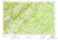
1971 Map of Roanoke
USGS Topo · Published 1977About this map
Lynchburg and Roanoke anchor this 1971 study of South-Central Virginia, where the Piedmont begins its ascent into the Blue Ridge and Allegheny Mountains. The map documents a landscape defined by its river systems and historical corridors, from the James River valley to the major reservoirs of Smith Mountain Lake and Leesville Lake on the Roanoke River. Significant historical markers include the Appomattox Court House Nat Hist Pk and Sayler's Creek Battlefield State Park, illustrating the region's prominence in Civil War history.
Find a feature on this map
118 named features on this map. Tap any name to fly to it.
Don’t see what you’re looking for? This feature index may not catch every label — zoom into the map to look around manually.
Map Details
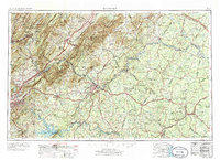
Editions of this 1971 Roanoke Map
2 editions found
Other maps of this area

1887 · Spottsylvania
USGS Topo · 1:125,000

1887 · Lewisburg
USGS Topo · 1:125,000

1890 · Goochland
USGS Topo · 1:125,000

1890 · Roanoke
USGS Topo · 1:125,000

1890 · Christiansburg
USGS Topo · 1:125,000

1891 · Roanoke
USGS Topo · 1:125,000

1891 · Palmyra
USGS Topo · 1:125,000

1891 · Farmville
USGS Topo · 1:125,000

1891 · Lewisburg
USGS Topo · 1:125,000

1891 · Huntersville
USGS Topo · 1:125,000