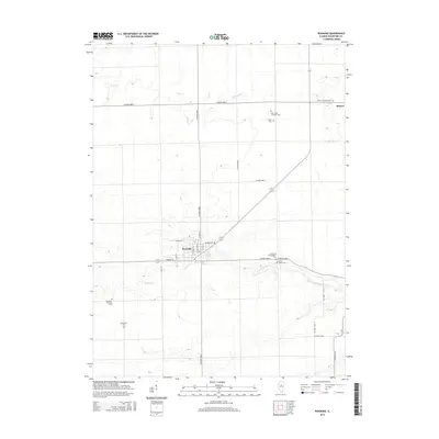
2015 Map of Roanoke
USGS Topo · Published 2015About this map
The agricultural landscape of Woodford County unfolds across this 2015 survey, anchored by the village of Roanoke and the western edge of Benson. This territory is defined by the headwaters of several streams, including Snake Cr, Snag Cr, and Hallenback Cr, which carve subtle drainage patterns through the productive Illinois prairie. The map provides significant genealogical value through its meticulous labeling of numerous rural burial sites. Researchers can locate the Apostolic Christian Cem and Mennonite Cem southwest of the primary settlement, while the Saint Peter Lutheran Cem and Trinity Cem serve the northern farming community. A network of county roads, such as Co Road 1800 N and Co Road 1800 E, maintains the traditional township grid system, though the diagonal route of Illinois 116/117 breaks the pattern as it passes through the heart of Roanoke and near the Roanoke Cem.
Find a feature on this map
34 named features on this map. Tap any name to fly to it.
Don’t see what you’re looking for? This feature index may not catch every label — zoom into the map to look around manually.
Map Details
Editions of this 2015 Roanoke Map
This is the sole edition of this map. No revisions or reprints were ever made.
Other maps of this area

1893 · Metamora
USGS Topo · 1:62,500

1927 · Danvers
USGS Topo · 1:62,500

1928 · Mackinaw
USGS Topo · 1:62,500

1930 · Danvers
USGS Topo · 1:62,500

1932 · Mackinaw
USGS Topo · 1:62,500

1937 · Metamora
USGS Topo · 1:62,500

1948 · Metamora
USGS Topo · 1:62,500

1955 · Minonk
USGS Topo · 1:62,500

1958 · Peoria
USGS Topo · 1:250,000

1961 · Peoria
USGS Topo · 1:250,000