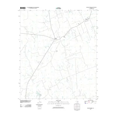
2010 Map of Roans Prairie
USGS Topo · Published 2010About this map
Roans Prairie and Shiro anchor this Grimes County landscape at the beginning of the 2010s, showing a rural Texas environment defined by family-named burial grounds and a complex network of seasonal waterways. The settlement at Shiro is situated in the northeast near the Shiro Cemetery, while Roans Prairie serves as a central hub where local roads converge. The map highlights several significant landmarks for local history and genealogy, including Oakland Cemetery and the Roans Prairie Cemetery.
Find a feature on this map
14 named features on this map. Tap any name to fly to it.
Don’t see what you’re looking for? This feature index may not catch every label — zoom into the map to look around manually.
Map Details
Editions of this 2010 Roans Prairie Map
This is the sole edition of this map. No revisions or reprints were ever made.
Other maps of this area

1914 · Navasota
USGS Topo · 1:62,500

1954 · Beaumont
USGS Topo · 1:250,000

1954 · Austin
USGS Topo · 1:250,000

1956 · Carlos
USGS Topo · 1:62,500

1957 · Beaumont
USGS Topo · 1:250,000

1958 · Navasota
USGS Topo · 1:24,000

1960 · Carlos
USGS Topo · 1:24,000

1961 · Anderson
USGS Topo · 1:24,000

1961 · Singleton
USGS Topo · 1:24,000

1962 · Dacus
USGS Topo · 1:24,000