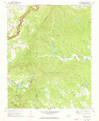
1971 Map of Roaring Gap
USGS Topo · Published 1973About this map
The Blue Ridge escarpment dominates this early 1970s landscape, where the Blue Ridge Parkway winds through the high terrain near the triple-county junction of Alleghany, Surry, and Wilkes. At the heart of the region, Roaring Gap serves as a focal point for mountain recreation and infrastructure, featuring a Fish Hatchery and the Roaring Gap Lookout Tower. The settlement pattern reflects the area's religious and community roots, with several country churches including Mt View Ch, Antioch Ch, and Mt Sinai Ch situated along the ridges and valley slopes.
Find a feature on this map
43 named features on this map. Tap any name to fly to it.
Don’t see what you’re looking for? This feature index may not catch every label — zoom into the map to look around manually.
Map Details
Editions of this 1971 Roaring Gap Map
2 editions found
Other maps of this area

1889 · Hillsville
USGS Topo · 1:125,000

1889 · Wytheville
USGS Topo · 1:125,000

1889 · Wilkesboro
USGS Topo · 1:125,000

1891 · Wilkesboro
USGS Topo · 1:125,000

1891 · Yadkinville
USGS Topo · 1:125,000

1892 · Hillsville
USGS Topo · 1:125,000

1892 · Wytheville
USGS Topo · 1:125,000

1893 · Yadkinville
USGS Topo · 1:125,000

1896 · Hillsville
USGS Topo · 1:125,000

1930 · Independence
USGS Topo · 1:48,000