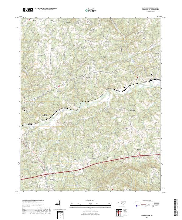
2022 Map of Roaring River
USGS Topo · Published 2022About this map
The Yadkin River and Roaring River define the local topography of this Wilkes County landscape, winding through a patchwork of family roads and long-standing rural communities. In the western reaches, the Wilkes County Airport stands as a modern landmark near North Wilkesboro, while the rest of the terrain is marked by historical religious and social centers. Numerous denominational anchors like White Plains Baptist Church and the Roaring River United Methodist Cem serve as vital records of local lineage.
Find a feature on this map
154 named features on this map. Tap any name to fly to it.
Don’t see what you’re looking for? This feature index may not catch every label — zoom into the map to look around manually.
Map Details
Editions of this 2022 Roaring River Map
This is the sole edition of this map. No revisions or reprints were ever made.
Other maps of this area

1889 · Wilkesboro
USGS Topo · 1:125,000

1891 · Wilkesboro
USGS Topo · 1:125,000

1891 · Yadkinville
USGS Topo · 1:125,000

1893 · Yadkinville
USGS Topo · 1:125,000

1953 · Winston-Salem
USGS Topo · 1:250,000

1955 · Winston-Salem
USGS Topo · 1:250,000

1962 · Winston-Salem
USGS Topo · 1:250,000
1966 · Gilreath
USGS Topo · 1:24,000

1966 · Roaring River
USGS Topo · 1:24,000
1966 · Moravian Falls
USGS Topo · 1:24,000