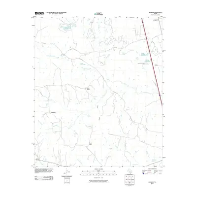
2010 Map of Robbins
USGS Topo · Published 2010About this map
Old Union Cemetery and Liberty Cemetery sit among the scattered rural settlements of Leon County, where this 2010 survey documents the quiet transition of East Texas woodland and pasture. The map focuses on a network of small communities including North Salem, South Salem, Friendship, and the namesake Robbins. This area is defined by the complex drainage of Lower Keechi Creek and its many tributaries like Little Keechi Creek and Reed Creek, creating a landscape dotted with wetlands and small water bodies such as Upper Flag Pond and Lower Flag Pond. The presence of the Tularosa Farms Lake Dam and several reservoirs, including Crews Lake Number 1, reflects a history of local water management for agricultural and farm use. A sparse road network, characterized by routes like Sand Banks Rd and the prominent Hwy 75 corridor, links these isolated homesteads and family burial grounds.
Find a feature on this map
53 named features on this map. Tap any name to fly to it.
Don’t see what you’re looking for? This feature index may not catch every label — zoom into the map to look around manually.
Map Details
Editions of this 2010 Robbins Map
This is the sole edition of this map. No revisions or reprints were ever made.
Other maps of this area

1953 · Palestine
USGS Topo · 1:250,000

1954 · Waco
USGS Topo · 1:250,000

1955 · Waco
USGS Topo · 1:250,000

1956 · Jewett
USGS Topo · 1:62,500

1957 · Palestine
USGS Topo · 1:250,000

1964 · Centerville
USGS Topo · 1:24,000

1964 · Flo
USGS Topo · 1:24,000

1964 · Spring Seat
USGS Topo · 1:24,000

1964 · Leona
USGS Topo · 1:24,000

1964 · Margie
USGS Topo · 1:24,000