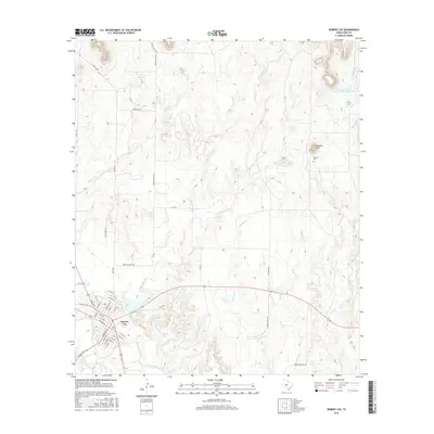
2016 Map of Robert Lee
USGS Topo · Published 2016About this map
Robert Lee serves as the focal point of this Coke County landscape, situated along the north bank of the Colorado River. The town's grid is clearly defined by historical thoroughfares like Commerce St and Houston St, bounded to the north by the waters of the Mountain Cr Reservoir. This geography reveals a community centered on water management and regional transit, with the Old City Lake and the Soil Conservation Service Site 1 Reservoir highlighting the critical role of conservation in the West Texas environment.
Find a feature on this map
51 named features on this map. Tap any name to fly to it.
Don’t see what you’re looking for? This feature index may not catch every label — zoom into the map to look around manually.
Map Details
Editions of this 2016 Robert Lee Map
This is the sole edition of this map. No revisions or reprints were ever made.
Other maps of this area

1891 · Hayrick
USGS Topo · 1:125,000

1893 · Sweetwater
USGS Topo · 1:125,000

1894 · Hayrick
USGS Topo · 1:125,000

1921 · Bronte
USGS Topo · 1:31,680

1921 · Mays School
USGS Topo · 1:31,680

1954 · Big Spring
USGS Topo · 1:250,000

1954 · San Angelo
USGS Topo · 1:250,000

1958 · San Angelo
USGS Topo · 1:250,000

1958 · Big Spring
USGS Topo · 1:250,000
1961 · Shawville
USGS Topo · 1:24,000