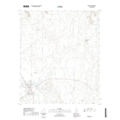
2019 Map of Robert Lee
USGS Topo · Published 2019About this map
The county seat of Robert Lee occupies a prominent position on the north bank of the Colorado River, where the landscape transitions into a network of creek drainages and rugged mesas. This 2019 survey documents the town's street grid, including residential corridors like Houston St and Adams St, and its central Po. To the northeast, the terrain rises sharply toward Hayrick Mtn, a significant landmark accompanied by the Hayrick Cem, which preserves a connection to the area's early settlement history. Water management is a defining characteristic of the surrounding Coke County countryside, with the Mountain Cr Reservoir and Old City Lake providing essential resources. Numerous watercourses, including Messbox Cr, Machae Cr, and Indian Cr, carve through the rolling hills, illustrating the drainage patterns that have shaped ranching and land use in this part of West Texas.
Find a feature on this map
53 named features on this map. Tap any name to fly to it.
Don’t see what you’re looking for? This feature index may not catch every label — zoom into the map to look around manually.
Map Details
Editions of this 2019 Robert Lee Map
This is the sole edition of this map. No revisions or reprints were ever made.
Other maps of this area

1891 · Hayrick
USGS Topo · 1:125,000

1893 · Sweetwater
USGS Topo · 1:125,000

1894 · Hayrick
USGS Topo · 1:125,000

1921 · Bronte
USGS Topo · 1:31,680

1921 · Mays School
USGS Topo · 1:31,680

1954 · Big Spring
USGS Topo · 1:250,000

1954 · San Angelo
USGS Topo · 1:250,000

1958 · San Angelo
USGS Topo · 1:250,000

1958 · Big Spring
USGS Topo · 1:250,000
1961 · Shawville
USGS Topo · 1:24,000