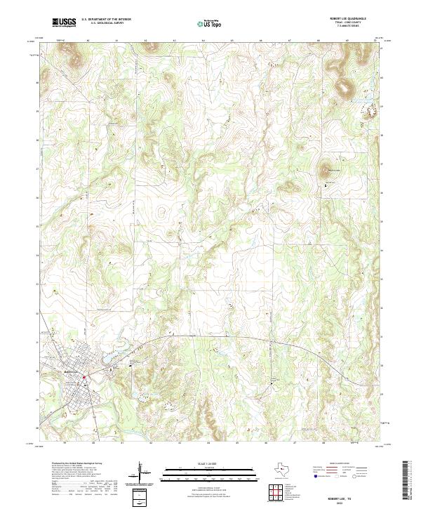
2022 Map of Robert Lee
USGS Topo · Published 2022About this map
The Coke County Courthouse stands as the central landmark in Robert Lee, anchoring a town site positioned between the Colorado River and the waters of Mountain Cr Reservoir. This West Texas landscape is defined by its drainage systems, where Mountain Cr, Indian Cr, and Messbox Cr cut through the terrain toward the river valley. The map reveals the area's social history through its distinct burial grounds, including the Robert Lee Cem, Robert Lee Hispanic Cem, and the more distant Hayrick Cem near the foot of Hayrick Mtn. Rural infrastructure is evident in the presence of the Soil Conservation Service Site 1 Reservoir and the network of ranch roads like Sanco Rd and Graham Valley Rd that connect the town to the surrounding cattle country.
Find a feature on this map
56 named features on this map. Tap any name to fly to it.
Don’t see what you’re looking for? This feature index may not catch every label — zoom into the map to look around manually.
Map Details
Editions of this 2022 Robert Lee Map
This is the sole edition of this map. No revisions or reprints were ever made.
Other maps of this area

1891 · Hayrick
USGS Topo · 1:125,000

1893 · Sweetwater
USGS Topo · 1:125,000

1894 · Hayrick
USGS Topo · 1:125,000

1921 · Bronte
USGS Topo · 1:31,680

1921 · Mays School
USGS Topo · 1:31,680

1954 · Big Spring
USGS Topo · 1:250,000

1954 · San Angelo
USGS Topo · 1:250,000

1958 · San Angelo
USGS Topo · 1:250,000

1958 · Big Spring
USGS Topo · 1:250,000
1961 · Shawville
USGS Topo · 1:24,000