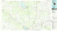
1986 Map of Robert Lee
USGS Topo · Published 1986About this map
The Colorado River and the Concho River systems dominate this West Texas landscape, where the massive E V Spence Reservoir provides a significant water resource for the surrounding ranching and oil-producing country. This mid-1980s compilation reveals a region defined by scattered cattle-country settlements like Robert Lee, Bronte, and Sterling City. Industrial activity is evident in several oil fields and a Quarry near the reservoir, while the rail-and-river economy is anchored by the Atchison Topeka and Santa Fe line connecting smaller towns like Rowena and Lowake to the larger hub of San Angelo. The terrain is punctuated by distinctive mesas and peaks, including Hayrick Mountain, Goat Mountain, and Nipple Peak, which serve as prominent landmarks across the plains. Historical sites such as Fort Chadbourne offer a glimpse into the frontier history of the area, while the network of canals, like the Main Canal near Carlsbad, illustrates the importance of irrigation to the local agricultural economy.
Find a feature on this map
114 named features on this map. Tap any name to fly to it.
Don’t see what you’re looking for? This feature index may not catch every label — zoom into the map to look around manually.
Map Details
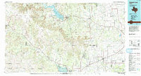
Editions of this 1986 Robert Lee Map
2 editions found
Other maps of this area

1890 · Abilene
USGS Topo · 1:125,000

1891 · Hayrick
USGS Topo · 1:125,000

1892 · San Angelo
USGS Topo · 1:125,000

1892 · Eden
USGS Topo · 1:125,000

1892 · Abilene
USGS Topo · 1:125,000

1892 · Ballinger
USGS Topo · 1:125,000

1893 · Sweetwater
USGS Topo · 1:125,000

1894 · Hayrick
USGS Topo · 1:125,000

1895 · Sherwood
USGS Topo · 1:125,000

1896 · Eden
USGS Topo · 1:125,000