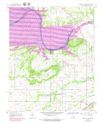
1967 Map of Robert S Kerr Dam
USGS Topo · Published 1979About this map
Robert S Kerr Reservoir dominates the northern landscape of this region where the Arkansas River winds through the borderlands of Sequoyah, Haskell, and Le Flore counties. The terrain transitions from the inundated Blaine Bottom to the high ground of Sans Bois Mountain and Gingle Mountain. Human activity is marked by a scattering of gas wells and resource extraction, including a strip mine and coal deposits in the south. The settlement of Cowlington sits at a geographic crossroads between the reservoir and the upland ridges. Local history is preserved in several burial grounds, such as Short Mountain Cem and Brent Cem, while technical infrastructure like the powerplant and gaging station near the river indicates the era's focus on hydroelectric management and water control.
Find a feature on this map
32 named features on this map. Tap any name to fly to it.
Don’t see what you’re looking for? This feature index may not catch every label — zoom into the map to look around manually.
Map Details
Editions of this 1967 Robert S Kerr Dam Map
3 editions found
Other maps of this area

1900 · Sallisaw
USGS Topo · 1:125,000

1911 · Sallisaw
USGS Topo · 1:125,000

1946 · Fort Smith
USGS Topo · 1:250,000

1965 · Fort Smith
USGS Topo · 1:250,000

1966 · Gans
USGS Topo · 1:24,000

1966 · Muldrow SW
USGS Topo · 1:24,000

1967 · Fort Smith
USGS Topo · 1:250,000
1967 · Keota
USGS Topo · 1:24,000
1967 · Sallisaw
USGS Topo · 1:24,000

1967 · Robert S Kerr Dam
USGS Topo · 1:24,000