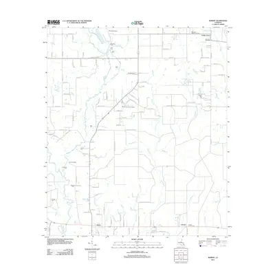
2012 Map of Robert
USGS Topo · Published 2012About this map
Tangipahoa River and the Tchefuncte River flank a region of southern Tangipahoa Parish where timber and agriculture shaped early settlement patterns. Small communities and family-named enclaves like Uneedus and Cranky Corner define the northern landscape, while the southern corridor shows more modern development near Robert and Lorraine. This 2012 survey reveals a deep layer of local genealogy through numerous family burial grounds, including Joiner Cem, Henen Cem, and the Wilson-Willie Cem to the east.
Find a feature on this map
120 named features on this map. Tap any name to fly to it.
Don’t see what you’re looking for? This feature index may not catch every label — zoom into the map to look around manually.
Map Details
Editions of this 2012 Robert Map
This is the sole edition of this map. No revisions or reprints were ever made.
Other maps of this area

1935 · Covington
USGS Topo · 1:62,500

1935 · Ponchatoula
USGS Topo · 1:62,500

1939 · Ponchatoula
USGS Topo · 1:62,500

1939 · Covington
USGS Topo · 1:62,500

1940 · Tickfaw
USGS Topo · 1:31,680

1942 · Onville
USGS Topo · 1:31,680

1942 · Husser
USGS Topo · 1:31,680

1942 · Robert
USGS Topo · 1:31,680

1942 · Loranger
USGS Topo · 1:31,680

1950 · Folsom
USGS Topo · 1:31,680