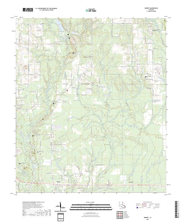
2024 Map of Robert
USGS Topo · Published 2024About this map
Uneedus and Lorraine anchor the rural landscape of eastern Tangipahoa Parish, where the land is defined by a dense network of tributaries feeding the Tangipahoa River. Numerous family-named burial grounds, such as the Wilson Willie Cemetery and Bankston Cem, are scattered across the terrain, reflecting the long-standing genealogical roots of this community. The settlement of Robert sits at a crossroads in the southern portion of the sheet, surrounded by numerous creeks including Skull Creek and Pole Bridge Branch. Small-scale aviation and agricultural services like Koenig Airpark and the Shaw Crop Service Airport highlight the mix of residential life and local utility. The intricate drainage patterns, from Chappepeela Creek to Baggage Branch, illustrate the low-lying, water-rich environment of this part of the Louisiana interior.
Find a feature on this map
93 named features on this map. Tap any name to fly to it.
Don’t see what you’re looking for? This feature index may not catch every label — zoom into the map to look around manually.
Map Details
Editions of this 2024 Robert Map
This is the sole edition of this map. No revisions or reprints were ever made.
Other maps of this area

1935 · Covington
USGS Topo · 1:62,500

1935 · Ponchatoula
USGS Topo · 1:62,500

1939 · Ponchatoula
USGS Topo · 1:62,500

1939 · Covington
USGS Topo · 1:62,500

1940 · Tickfaw
USGS Topo · 1:31,680

1942 · Onville
USGS Topo · 1:31,680

1942 · Husser
USGS Topo · 1:31,680

1942 · Robert
USGS Topo · 1:31,680

1942 · Loranger
USGS Topo · 1:31,680

1950 · Folsom
USGS Topo · 1:31,680