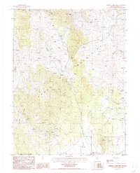
1986 Map of Roberts Creek Mtn.
USGS Topo · Published 1986About this map
The Roberts Mountains dominate this 1980s landscape, where high-altitude springs feed a network of drainages including Vinini Creek and Rutabaga Creek. The presence of numerous mining prospects scattered across the slopes reflects the region's enduring mineral exploration history. Cultural features are sparse but significant, centered on the Roberts Creek Ranch in the southern portion of the quadrangle. A primary historical corridor is visible along the southern edge, where the Old Pony Express Trail crosses the terrain near a local Corral. This survey illustrates a remote ranching and mining environment, where water sources like Pete Hanson Creek and various stock tanks are the primary markers of human activity amidst the high peaks of Roberts Creek Mountain.
Find a feature on this map
17 named features on this map. Tap any name to fly to it.
Don’t see what you’re looking for? This feature index may not catch every label — zoom into the map to look around manually.
Map Details
Editions of this 1986 Roberts Creek Mtn. Map
2 editions found
Other maps of this area

1926 · Roberts Mountains
USGS Topo · 1:250,000

1929 · Roberts Mountains
USGS Topo · 1:250,000

1949 · Garden Valley
USGS Topo · 1:62,500

1949 · Roberts Creek Mtn
USGS Topo · 1:62,500

1951 · Roberts Creek Mtn
USGS Topo · 1:62,500

1951 · Garden Valley
USGS Topo · 1:62,500

1955 · Millett
USGS Topo · 1:250,000

1956 · Bartine Ranch
USGS Topo · 1:62,500

1956 · Whistler Mtn
USGS Topo · 1:62,500

1959 · Millett
USGS Topo · 1:250,000