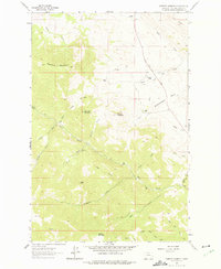
1961 Map of Roberts Mountain
USGS Topo · Published 1975About this map
Ranching life and high-elevation terrain define this 1961 study of Lewis and Clark County, Montana. The map documents a landscape of scattered homesteads and family holdings, including the B Hicks Ranch, Johnson Homestead, and Garrow Ranch, positioned along the drainage basins of Wolf Creek and Rattlesnake Creek. The geography is dominated by a series of significant peaks and ridges such as Roberts Mountain, Lannigan Mountain, and the massive geological formation known as The Reef to the north. Evidence of mineral exploration appears at the Rosetta Mine near the headwaters of Carter Creek. Transportation is largely restricted to the Stearns Wolf Creek Road, which winds through the mountain passes to connect these isolated settlements. This survey provides a rare look at the mid-century spatial distribution of these ranching outposts before later consolidation changed the rural mountain character.
Find a feature on this map
40 named features on this map. Tap any name to fly to it.
Don’t see what you’re looking for? This feature index may not catch every label — zoom into the map to look around manually.
Map Details
Editions of this 1961 Roberts Mountain Map
2 editions found
Other maps of this area

1889 · Helena
USGS Topo · 1:250,000

1893 · Helena
USGS Topo · 1:250,000

1899 · Helena
USGS Topo · 1:250,000

1903 · Helena
USGS Topo · 1:250,000

1943 · Hogan
USGS Topo · 1:125,000

1947 · Butte
USGS Topo · 1:250,000

1955 · Choteau
USGS Topo · 1:250,000

1957 · Choteau
USGS Topo · 1:250,000

1958 · Butte
USGS Topo · 1:250,000

1958 · Choteau
USGS Topo · 1:250,000