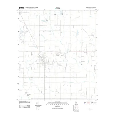
2011 Map of Robertsdale
USGS Topo · Published 2011About this map
Robertsdale serves as the central hub of this Baldwin County landscape, where the intersection of state and local roads anchors a transition from town center to agricultural and woodland tracks. The town’s social and civic geography is marked by the Baldwin County Coliseum and the Robertsdale Post Office, with the Blackwater River and Rock Creek providing a natural framework for the surrounding countryside. This 2011 survey documents a dense concentration of memorial sites, including Baldwin Memorial Cemetery, Hall Memorial Cemetery, and Coopers Cemetery near the settlement of Rosinton. The presence of numerous private lake dams, such as Paul Childress Lake Dam and the multiple Calvin Childress Lake Dams, reflects a legacy of local land management and small-scale water control in this coastal plain environment.
Find a feature on this map
134 named features on this map. Tap any name to fly to it.
Don’t see what you’re looking for? This feature index may not catch every label — zoom into the map to look around manually.
Map Details
Editions of this 2011 Robertsdale Map
This is the sole edition of this map. No revisions or reprints were ever made.
Other maps of this area

1920 · Robertsdale
USGS Topo · 1:62,500

1921 · Bon Secour
USGS Topo · 1:62,500

1921 · Point Clear
USGS Topo · 1:62,500

1921 · Fairhope
USGS Topo · 1:62,500

1940 · Silverhill
USGS Topo · 1:31,680

1941 · Silverhill
USGS Topo · 1:31,680

1941 · Robertsdale
USGS Topo · 1:62,500

1941 · Foley
USGS Topo · 1:62,500

1941 · Weeks Bay
USGS Topo · 1:62,500

1941 · Fairhope
USGS Topo · 1:62,500