2021 Map of Robertson
USGS Topo · Published 2021About this map
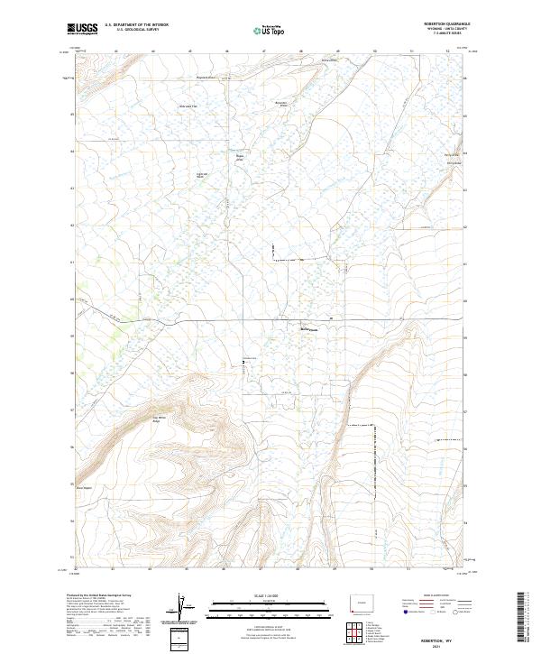
Robertson serves as the central hub of this Uinta County landscape, situated near the confluence of several vital water management systems. The terrain is characterized by a sophisticated network of irrigation and transport canals, including the Pine Grove Canal, Lambs Supply Ditch, Murray Ditch, and Milich Ditch, reflecting the area's agricultural reliance on the Blacks Fork and Smiths Fork waterways. Local genealogy is anchored by the Johnson Cem located south of the main settlement. The topography rises significantly toward the south, marked by the prominent Cap White Ridge and the distinctively named Dans Nipple peak. This survey captures a rural Wyoming ranching environment where named features like Nebraska Flat and Ingersoll Wash describe a landscape defined by its drainage patterns and high-desert flats.
Find a feature on this map
44 named features on this map. Tap any name to fly to it.
Don’t see what you’re looking for? This feature index may not catch every label — zoom into the map to look around manually.
Map Details
Editions of this 2021 Robertson Map
This is the sole edition of this map. No revisions or reprints were ever made.