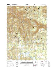
2014 Map of Robinson Butte
USGS Topo · Published 2014About this map
Robinson Butte and the surrounding high-country terrain of the Rogue River National Forest define this 2014 survey. This portion of Jackson County is characterized by a high-altitude network of meadows and water sources, including Service Glades, Short Creek Prairie, and the northern reaches of Howard Prairie Lake. The hydrology of the area is complex, with the headwaters of the S Fork Little Butte Cr and Dead Indian Cr carving through the landscape, alongside smaller features like Owens Spring and Dead Indian Springs.
Find a feature on this map
50 named features on this map. Tap any name to fly to it.
Don’t see what you’re looking for? This feature index may not catch every label — zoom into the map to look around manually.
Map Details
Editions of this 2014 Robinson Butte Map
This is the sole edition of this map. No revisions or reprints were ever made.
Other maps of this area

1891 · Ashland
USGS Topo · 1:250,000

1893 · Ashland
USGS Topo · 1:250,000

1897 · Ashland
USGS Topo · 1:250,000

1938 · Medford
USGS Topo · 1:125,000

1954 · Lakecreek
USGS Topo · 1:62,500

1954 · Ashland
USGS Topo · 1:62,500

1955 · Hyatt Reservoir
USGS Topo · 1:62,500

1955 · Mt. Mc Loughlin
USGS Topo · 1:62,500

1955 · Medford
USGS Topo · 1:250,000

1957 · Medford
USGS Topo · 1:250,000