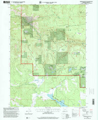
1997 Map of Robinson Butte
USGS Topo · Published 2000About this map
Robinson Butte Lookout 5884 stands as a prominent high point in this section of the Rogue River National Forest, overlooking a landscape defined by high-altitude meadows and managed forest lands. The 1990s terrain is marked by a network of ranching and early recreational infrastructure, including the Dahak Ranch and Bean Ranch, alongside the Dead Indian Soda Springs. The southern portion of the sheet is dominated by the reservoir waters of Howard Prairie Lake and the associated Howard Prairie County Recreation Area, highlighting the area's importance for water management and public access. Evidence of the region's hydro-engineering is clear in the South Fork Talent Irrigation Dist Canal and the Deadwood Tunnel. Smaller settlements and clearings like Deadwood and Lilyglen provide focal points for local history, showing the distribution of human activity amidst the drainages of Grizzly Creek and Dead Indian Creek.
Find a feature on this map
40 named features on this map. Tap any name to fly to it.
Don’t see what you’re looking for? This feature index may not catch every label — zoom into the map to look around manually.
Map Details
Editions of this 1997 Robinson Butte Map
This is the sole edition of this map. No revisions or reprints were ever made.
Other maps of this area

1891 · Ashland
USGS Topo · 1:250,000

1893 · Ashland
USGS Topo · 1:250,000

1897 · Ashland
USGS Topo · 1:250,000

1938 · Medford
USGS Topo · 1:125,000

1954 · Lakecreek
USGS Topo · 1:62,500

1954 · Ashland
USGS Topo · 1:62,500

1955 · Hyatt Reservoir
USGS Topo · 1:62,500

1955 · Mt. Mc Loughlin
USGS Topo · 1:62,500

1955 · Medford
USGS Topo · 1:250,000

1957 · Medford
USGS Topo · 1:250,000