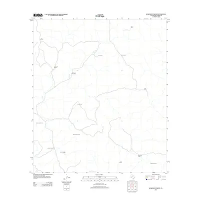
2012 Map of Robinson Draw
USGS Topo · Published 2012About this map
Whitehead Brothers Ranch and other remote holdings define this corner of the Edwards Plateau in Val Verde County. The landscape is structured by the seasonal drainage of Dolan Cr and the prominent Robinson Draw, which carve through the arid terrain. This 2012 survey illustrates the critical role of water management in West Texas ranching, documenting a high density of named water-pumping infrastructure essential for livestock. A network of named wells, including the Alta Windmill, Pastry Windmill, and Double Dolan Windmill, are positioned across the quadrangle to sustain operations at established sites like Taylor Ranch and Rose Ranch. The scarcity of permanent settlements and the reliance on these scattered windmills highlight the enduring challenges of land use in this sparsely populated region.
Find a feature on this map
16 named features on this map. Tap any name to fly to it.
Don’t see what you’re looking for? This feature index may not catch every label — zoom into the map to look around manually.
Map Details
Editions of this 2012 Robinson Draw Map
This is the sole edition of this map. No revisions or reprints were ever made.
Other maps of this area

1943 · Carta Valley
USGS Topo · 1:62,500

1944 · Dry Devil
USGS Topo · 1:62,500

1954 · Sonora
USGS Topo · 1:250,000

1958 · Sonora
USGS Topo · 1:250,000

1958 · Del Rio
USGS Topo · 1:250,000

1964 · Del Rio
USGS Topo · 1:250,000

1973 · Turney Draw NW
USGS Topo · 1:24,000

1973 · White Draw NW
USGS Topo · 1:24,000

1973 · Robinson Draw
USGS Topo · 1:24,000

1973 · Four Mills
USGS Topo · 1:24,000