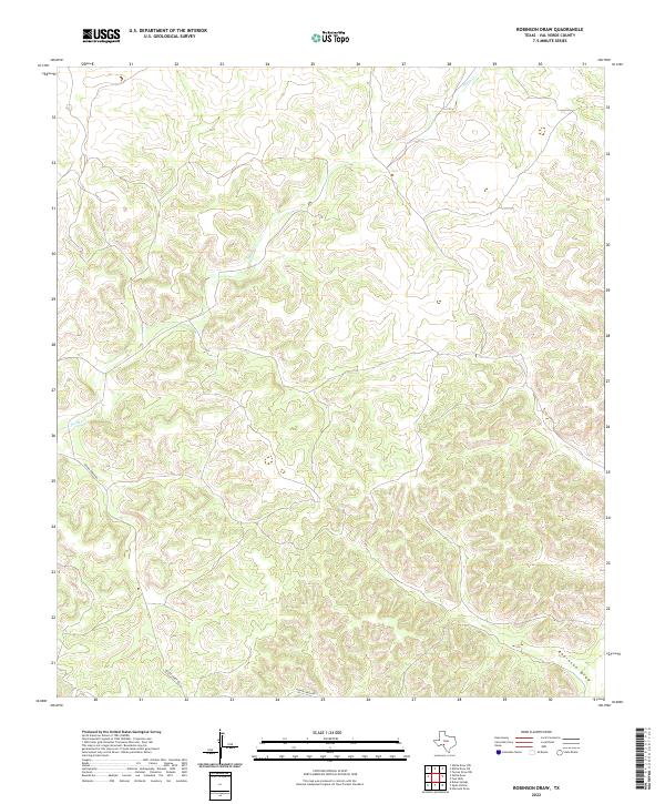
2022 Map of Robinson Draw
USGS Topo · Published 2022About this map
Dolan Creek Rd provides the primary access through this dissected plateau in Val Verde County, following the natural contours of the West Texas landscape. The drainage patterns are defined by the winding course of Dolan Cr in the northern and central sections, while the southeastern corner is dominated by the broad topographic depression of Robinson Draw. This 2022 survey illustrates the modern configuration of these ephemeral watercourses and the sparse transportation network that characterizes this part of the Edwards Plateau. The intricate contour lines reveal a complex system of ridges and valleys, typical of the region's limestone geology, where water management and seasonal drainage dictate the utility of the land.
Find a feature on this map
3 named features on this map. Tap any name to fly to it.
Don’t see what you’re looking for? This feature index may not catch every label — zoom into the map to look around manually.
Map Details
Editions of this 2022 Robinson Draw Map
This is the sole edition of this map. No revisions or reprints were ever made.
Other maps of this area

1943 · Carta Valley
USGS Topo · 1:62,500

1944 · Dry Devil
USGS Topo · 1:62,500

1954 · Sonora
USGS Topo · 1:250,000

1958 · Sonora
USGS Topo · 1:250,000

1958 · Del Rio
USGS Topo · 1:250,000

1964 · Del Rio
USGS Topo · 1:250,000

1973 · Turney Draw NW
USGS Topo · 1:24,000

1973 · White Draw NW
USGS Topo · 1:24,000

1973 · Robinson Draw
USGS Topo · 1:24,000

1973 · Four Mills
USGS Topo · 1:24,000