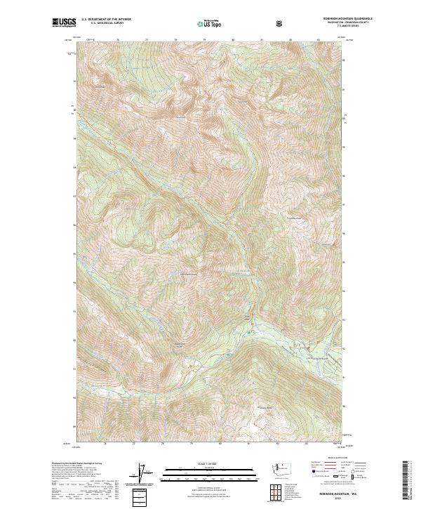
2023 Map of Robinson Mountain
USGS Topo · Published 2023About this map
The Methow River flows through the southeastern portion of this map, carving a path between high peaks and creating the Methow Valley. This landscape is defined by the intersection of the Pasayten Wilderness and Okanogan National Forest, where steep ridges lead to notable heights such as Robinson Mtn, Devils Peak, and Beauty Peak. The area serves as a significant recreational corridor, evidenced by the small Lost River Resort Airport and numerous backcountry routes including the Robinson Creek Trl and W Fork Methow Trl. Water features like Lake Hazard and Robinson Creek drain the high country, while lookout spots such as Vista Point and Last Chance Point suggest the expansive views available from the local ridges.
Find a feature on this map
44 named features on this map. Tap any name to fly to it.
Don’t see what you’re looking for? This feature index may not catch every label — zoom into the map to look around manually.
Map Details
Editions of this 2023 Robinson Mountain Map
This is the sole edition of this map. No revisions or reprints were ever made.
Other maps of this area

1920 · Slate Pass
USGS Topo · 1:125,000

1955 · Concrete
USGS Topo · 1:250,000

1958 · Concrete
USGS Topo · 1:250,000

1962 · Concrete
USGS Topo · 1:250,000

1962 · Mazama
USGS Topo · 1:62,500

1963 · Washington Pass
USGS Topo · 1:24,000

1963 · Slate Peak
USGS Topo · 1:24,000

1963 · Silver Star Mtn.
USGS Topo · 1:24,000
1963 · Robinson Mtn.
USGS Topo · 1:24,000

1969 · Lost Peak
USGS Topo · 1:24,000