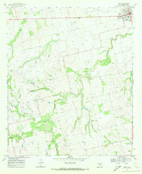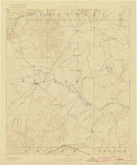
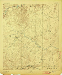
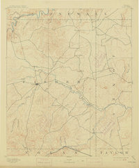
1893 Map of Roby
USGS Topo · Published 1922About this map
Roby serves as the focal point of this nineteenth-century survey, situated at the heart of Fisher County where the rolling terrain of the West Texas plains meets the drainage systems of the Brazos. The landscape is defined by the winding course of the Clear Fork of Brazos River and the Double Mountain Fork, which carve through the plains and create a complex network of seasonal creeks like Sandy Creek and Cottonwood Creek. Small agricultural communities and early post offices are scattered across the sheet, including Swedonia, Taopi, and Neinda, reflecting a period of rural expansion before the intensification of modern ranching. Along the southern border, the Texas and Pacific railroad facilitates transport through Eskota, while isolated landmarks like Monument Peak and Winters Chapel provide essential orientation for early settlers and travelers navigating the open country between the river forks.
Find a feature on this map
46 named features on this map. Tap any name to fly to it.
Don’t see what you’re looking for? This feature index may not catch every label — zoom into the map to look around manually.
Map Details
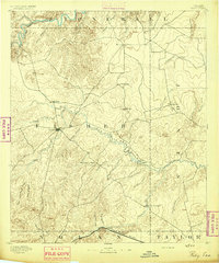
Editions of this 1893 Roby Map
4 editions found
Historical Maps of Sweetwater Through Time
7 maps found