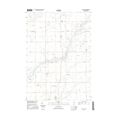
2015 Map of Roche A Cri
USGS Topo · Published 2015About this map
Big Roche a Cri Creek carves a winding path through this central Wisconsin landscape, feeding into the expansive Big Roche Lake and Big Roche a Cri Lake. The settlement patterns here are defined by small rural hubs such as Arkdale in the southwest and Big Flats to the north, connected by an orderly grid of local roads like Cottonville Ave and Chicago Ave.
Find a feature on this map
42 named features on this map. Tap any name to fly to it.
Don’t see what you’re looking for? This feature index may not catch every label — zoom into the map to look around manually.
Map Details
Editions of this 2015 Roche A Cri Map
This is the sole edition of this map. No revisions or reprints were ever made.
Other maps of this area

1955 · Green Bay
USGS Topo · 1:250,000

1957 · Madison
USGS Topo · 1:250,000

1958 · Arkdale
USGS Topo · 1:48,000

1958 · Coloma
USGS Topo · 1:48,000

1960 · Madison
USGS Topo · 1:250,000

1961 · Oxford
USGS Topo · 1:62,500

1961 · Adams
USGS Topo · 1:62,500

1967 · Roche A Cri
USGS Topo · 1:24,000

1967 · Arkdale NE
USGS Topo · 1:24,000
1967 · Arkdale
USGS Topo · 1:24,000