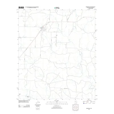
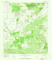
2012 Map of Rochelle
USGS Topo · Published 2012About this map
Rochelle sits at the intersection of several local routes in this McCulloch County landscape, where the town's small grid of streets transitions into a network of ranch roads and county thoroughfares. The local cemetery, Rochelle Cem, is situated just east of the main settlement area, providing a point of interest for those tracing family history in the region. The terrain is defined by a dendritic drainage system where Little Brady Cr and its various branches, along with Onion Cr, carve through the Texas brush country. To the southwest, the topography rises toward Bryson Hill and dips into Sweden Hollow, showing the subtle but varied elevation of the central Texas plateau. This 2012 survey illustrates a quiet ranching community maintained through a dense network of managed roads like Brasade Ranch Rd and FM-1121.
Find a feature on this map
25 named features on this map. Tap any name to fly to it.
Don’t see what you’re looking for? This feature index may not catch every label — zoom into the map to look around manually.
Map Details
Editions of this 2012 Rochelle Map
This is the sole edition of this map. No revisions or reprints were ever made.
Other maps of this area

1894 · Brady
USGS Topo · 1:125,000

1928 · Mercury
USGS Topo · 1:62,500

1928 · Waldrip
USGS Topo · 1:62,500

1950 · Mercury
USGS Topo · 1:62,500

1954 · Brownwood
USGS Topo · 1:250,000

1960 · Brady North
USGS Topo · 1:24,000
1963 · Pecan Springs
USGS Topo · 1:24,000
1963 · Voca
USGS Topo · 1:24,000
1963 · Lost Creek
USGS Topo · 1:24,000
1963 · Rochelle
USGS Topo · 1:24,000