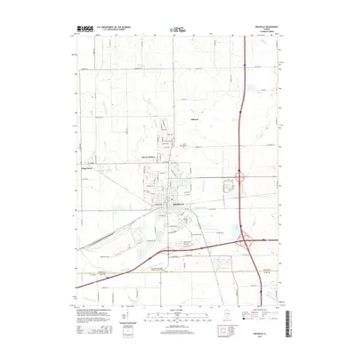
2015 Map of Rochelle
USGS Topo · Published 2015About this map
Rochelle serves as a significant regional hub where the Kyte River and several artificial waterways, including N Creston Ditch and Banning Lateral, intersect the landscape. This 2015 survey illustrates a community deeply integrated with its transportation infrastructure, from the Rochelle Municipal Airport-Koritz Field in the south to the complex interchange systems of the modern era. Residential expansion is noted in the Askvig Addition and the neighboring village of Hillcrest. Local history and genealogy are anchored by several established burial grounds, such as Lawnridge Cem, Saint Patrick's Cem, and Trinity Memorial Cem. The map reveals how water management has shaped the Ogle and Lee County borderlands, with features like Lake Sule and Lake Lida punctuating the terrain near the interstate corridors. The rural character of the surrounding area is preserved in the smaller settlement of Flagg Center, surrounded by a grid of named roads like E Twombly Rd and S Mulford Rd.
Find a feature on this map
75 named features on this map. Tap any name to fly to it.
Don’t see what you’re looking for? This feature index may not catch every label — zoom into the map to look around manually.
Map Details
Editions of this 2015 Rochelle Map
This is the sole edition of this map. No revisions or reprints were ever made.
Other maps of this area

1917 · Kings
USGS Topo · 1:62,500

1918 · Kings
USGS Topo · 1:62,500

1918 · Kirkland
USGS Topo · 1:62,500

1934 · De Kalb
USGS Topo · 1:62,500

1937 · De Kalb
USGS Topo · 1:62,500

1952 · Rochelle
USGS Topo · 1:62,500

1954 · Rockford
USGS Topo · 1:250,000

1955 · Rockford
USGS Topo · 1:250,000

1958 · Aurora
USGS Topo · 1:250,000

1958 · Rockford
USGS Topo · 1:250,000