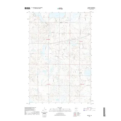
2019 Map of Rochert
USGS Topo · Published 2019About this map
Rochert serves as the central hub of this Becker County landscape, situated at a junction near the northern banks of Cotton Lake. The terrain is defined by a dense concentration of glacial lakes and wetlands, connected by the winding course of the Otter Tail River. This 2019 survey documents a rural community deeply rooted in its local history, evidenced by numerous family and denominational burial grounds including the Dretsch Family Memorial Cem, Mennonite Cem, and Mount Olive Cem. The presence of the N Country National Scenic Trail cutting through the eastern half of the quadrangle highlights the area's transition toward recreational land use. Local transport is facilitated by a network of county roads like Co Rd 29 and Co Rd 32, which link smaller water bodies such as Trieglaff Lake and Hungry Lake to the more established settlements.
Find a feature on this map
66 named features on this map. Tap any name to fly to it.
Don’t see what you’re looking for? This feature index may not catch every label — zoom into the map to look around manually.
Map Details
Editions of this 2019 Rochert Map
This is the sole edition of this map. No revisions or reprints were ever made.
Other maps of this area

1912 · Vergas
USGS Topo · 1:62,500

1915 · Perham
USGS Topo · 1:62,500

1915 · Vergas
USGS Topo · 1:62,500

1953 · Brainerd
USGS Topo · 1:250,000

1957 · Brainerd
USGS Topo · 1:250,000

1958 · Brainerd
USGS Topo · 1:250,000

1959 · Toad Mountain
USGS Topo · 1:24,000

1959 · Flat Lake
USGS Topo · 1:24,000

1959 · Rochert
USGS Topo · 1:24,000

1959 · Richwood
USGS Topo · 1:24,000