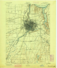
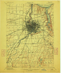
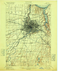
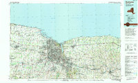
1960 Map of Rochester
USGS Topo · Published 1960About this map
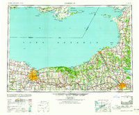
Rochester and Syracuse anchor the Southern shore of Lake Ontario in this mid-century view of Western New York, showing the post-war expansion of the Great Lakes region. The landscape is defined by the legacy of the Erie Canal and the extensive tracks of the New York Central railroad, which fostered the growth of industrial hubs like Fulton and Oswego. Further north, the international boundary passes through the open water toward the Canadian shoreline, where the Picton R C A F airbase and the Point Petre Lighthouse mark the strategic importance of the Prince Edward County peninsula.
Find a feature on this map
364 named features on this map. Tap any name to fly to it.
Don’t see what you’re looking for? This feature index may not catch every label — zoom into the map to look around manually.
Map Details
Editions of this 1960 Rochester Map
2 editions found
Historical Maps of Rochester Through Time
7 maps found