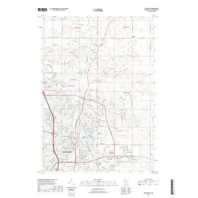
2019 Map of Rochester
USGS Topo · Published 2019About this map
The city of Rochester dominates the southern half of this modern survey, revealing the dense urban core and medical centers that define the region. The S Fork Zumbro River and Cascade Cr converge near the city center, feeding into Silver Lake, while institutions like the Mayo Graduate School and Rochester Community and Technical College highlight the area's development. North of the city, the landscape transitions toward the small settlement of Ringe and the distinct geography of Hadley Valley. Genealogists and local historians will find significant value in the documentation of several burial grounds, including the large Oakwood Cemetery, Calvary Cem, and the specialized Rochester State Hospital Cem, which provide a clear record of the community's heritage and institutional growth.
Find a feature on this map
159 named features on this map. Tap any name to fly to it.
Don’t see what you’re looking for? This feature index may not catch every label — zoom into the map to look around manually.
Map Details
Editions of this 2019 Rochester Map
This is the sole edition of this map. No revisions or reprints were ever made.
Other maps of this area

1935 · Rochester
USGS Topo · 1:48,000

1939 · Rochester
USGS Topo · 1:62,500

1953 · Saint Paul
USGS Topo · 1:250,000

1954 · Mason City
USGS Topo · 1:250,000

1955 · Stewartville
USGS Topo · 1:62,500

1955 · High Forest
USGS Topo · 1:62,500

1957 · Mason City
USGS Topo · 1:250,000

1958 · Mason City
USGS Topo · 1:250,000

1959 · Saint Paul
USGS Topo · 1:250,000

1965 · Oronoco
USGS Topo · 1:24,000