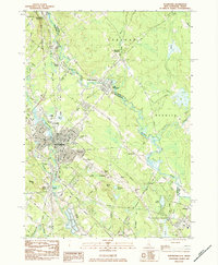
1983 Map of Rochester
USGS Topo · Published 1984About this map
The Salmon Falls River serves as the dividing line between New Hampshire and Maine in this detailed look at Rochester and its surrounding communities during the early 1980s. The industrial and transit patterns of the region are clearly defined by the path of the Boston and Maine Railroad and the Spaulding Turnpike, which facilitate movement between the urban center and outlying settlements like Gonic and East Rochester. Genealogists will find a dense collection of burial sites, including the Cimetière Du St Rosaire and Mont-Calvaire Cemetery, reflecting the cultural heritage of the area's residents.
Find a feature on this map
66 named features on this map. Tap any name to fly to it.
Don’t see what you’re looking for? This feature index may not catch every label — zoom into the map to look around manually.
Map Details
Editions of this 1983 Rochester Map
2 editions found
Other maps of this area

1891 · Berwick
USGS Topo · 1:62,500

1893 · Dover
USGS Topo · 1:62,500

1893 · Berwick
USGS Topo · 1:62,500

1916 · Dover
USGS Topo · 1:62,500

1917 · Mt. Pawtuckaway
USGS Topo · 1:62,500

1918 · Dover
USGS Topo · 1:62,500

1919 · Mt. Pawtuckaway
USGS Topo · 1:62,500

1919 · Alton
USGS Topo · 1:62,500

1933 · Berwick
USGS Topo · 1:48,000

1937 · Berwick
USGS Topo · 1:62,500