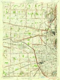
1935 Map of Rochester West
USGS Topo · Published 1935About this map
The industrial and civic expansion of Rochester dominates this 1930s landscape, where the sprawling Kodak Park complex serves as a massive anchor for the city's northern neighborhoods. The survey highlights the sophisticated institutional presence of the era, from the St Bernards Seminary overlooking the Genesee River to the Nazareth Convent and several high schools including Aquinas Institute and West High School.
Find a feature on this map
82 named features on this map. Tap any name to fly to it.
Don’t see what you’re looking for? This feature index may not catch every label — zoom into the map to look around manually.
Map Details
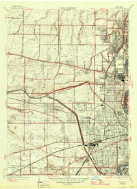
Editions of this 1935 Rochester West Map
2 editions found
Other maps of this area

1895 · Rochester
USGS Topo · 1:62,500

1895 · Ontario Beach
USGS Topo · 1:62,500

1898 · Rochester
USGS Topo · 1:62,500

1899 · Hamlin
USGS Topo · 1:62,500

1899 · Ontario Beach
USGS Topo · 1:62,500

1899 · Brockport
USGS Topo · 1:62,500

1912 · Rochester
USGS Topo · 1:62,500

1912 · Ontario Beach
USGS Topo · 1:62,500

1920 · Rochester
USGS Topo · 1:62,500

1931 · Mendon Ponds
USGS Topo · 1:24,000