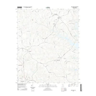
2014 Map of Rock Branch
USGS Topo · Published 2014About this map
Richard B Russell Lake dominates the eastern boundary of this Elbert County landscape, where the waters meet a terrain marked by deep-rooted Georgia settlements. The area is defined by its small community hubs, including Ruckersville, Harmony, and Rock Branch, each centered around historic gathering places and local landmarks like Fains Store. The density of burial sites, such as New Bethel Cem and Vans Creek Cem, points to the long-standing genealogical history of these rural crossroads.
Find a feature on this map
96 named features on this map. Tap any name to fly to it.
Don’t see what you’re looking for? This feature index may not catch every label — zoom into the map to look around manually.
Map Details
Editions of this 2014 Rock Branch Map
This is the sole edition of this map. No revisions or reprints were ever made.
Other maps of this area

1893 · Elberton
USGS Topo · 1:125,000

1954 · Greenville
USGS Topo · 1:250,000

1958 · Greenville
USGS Topo · 1:250,000

1958 · Elberton
USGS Topo · 1:62,500

1959 · Hartwell Dam
USGS Topo · 1:24,000

1959 · Hartwell
USGS Topo · 1:24,000

1964 · Iva
USGS Topo · 1:24,000

1964 · Lowndesville
USGS Topo · 1:24,000
1964 · Heardmont
USGS Topo · 1:24,000
1972 · Rock Branch
USGS Topo · 1:24,000