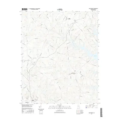
2017 Map of Rock Branch
USGS Topo · Published 2017About this map
Rock Branch and Ruckersville anchor this northern Elbert County landscape, where the terrain is defined by a dense network of tributaries flowing toward the Savannah River basin. The eastern edge of the map is dominated by the sprawling waters of Richard B Russell Lake, which has significantly altered the original river valley profile. This area reflects a long-standing rural community structure, visible through the numerous burial grounds like Rock Branch Cem, New Bethel Cem, and Vans Creek Cem that dot the countryside.
Find a feature on this map
91 named features on this map. Tap any name to fly to it.
Don’t see what you’re looking for? This feature index may not catch every label — zoom into the map to look around manually.
Map Details
Editions of this 2017 Rock Branch Map
This is the sole edition of this map. No revisions or reprints were ever made.
Other maps of this area

1893 · Elberton
USGS Topo · 1:125,000

1954 · Greenville
USGS Topo · 1:250,000

1958 · Greenville
USGS Topo · 1:250,000

1958 · Elberton
USGS Topo · 1:62,500

1959 · Hartwell Dam
USGS Topo · 1:24,000

1959 · Hartwell
USGS Topo · 1:24,000

1964 · Iva
USGS Topo · 1:24,000

1964 · Lowndesville
USGS Topo · 1:24,000
1964 · Heardmont
USGS Topo · 1:24,000
1972 · Rock Branch
USGS Topo · 1:24,000