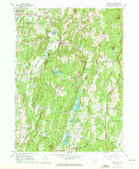
1963 Map of Rock City
USGS Topo · Published 1972About this map
Rock City and the surrounding township of Rhinebeck are characterized by a diverse landscape of wetlands and small agricultural communities in the early 1960s. The area is defined by its water systems, including the Saw Kill in the north and the winding Wappinger Creek which flows through the center of the sheet. Notable for aviation enthusiasts is the Old Rhinebeck Aerodrome located near the western edge, while genealogists will find several small burial grounds such as Shookville Cem and Milan Cem.
Find a feature on this map
46 named features on this map. Tap any name to fly to it.
Don’t see what you’re looking for? This feature index may not catch every label — zoom into the map to look around manually.
Map Details
Editions of this 1963 Rock City Map
3 editions found
Other maps of this area

1895 · Catskill
USGS Topo · 1:62,500

1898 · Rhinebeck
USGS Topo · 1:62,500

1899 · Millbrook
USGS Topo · 1:62,500

1902 · Millbrook
USGS Topo · 1:62,500

1902 · Copake
USGS Topo · 1:62,500

1904 · Copake
USGS Topo · 1:62,500

1934 · Rhinebeck
USGS Topo · 1:48,000

1934 · Catskill
USGS Topo · 1:62,500

1938 · Catskill
USGS Topo · 1:62,500

1939 · Rhinebeck
USGS Topo · 1:62,500