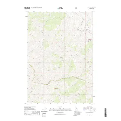
2020 Map of Rock Creek
USGS Topo · Published 2020About this map
Challis National Forest dominates this central Idaho landscape, where high-elevation ridgelines and deep drainage basins define the wilderness character of the Lemhi and Custer County border. The map provides a detailed look at the complex hydrography of the region, anchored by the winding course of Loon Creek and its many tributaries, including Warm Springs Creek and Cottonwood Creek. The transport network is sparse, reflecting the remote nature of the terrain, yet it includes significant back-country routes like the Sleeping Deer Road (Winter Trail) and Nat For Dev Rd 86. Prominent topographical features such as Bridge Creek Ridge and Hot Creek Ridge divide the various creek valleys, illustrating the natural barriers that have historically dictated movement through these mountains. This survey serves as a modern record of public lands and water resources before any shifts in forest management or natural environmental change.
Find a feature on this map
27 named features on this map. Tap any name to fly to it.
Don’t see what you’re looking for? This feature index may not catch every label — zoom into the map to look around manually.
Map Details
Editions of this 2020 Rock Creek Map
This is the sole edition of this map. No revisions or reprints were ever made.
Other maps of this area

1930 · Casto
USGS Topo · 1:125,000

1957 · Challis
USGS Topo · 1:250,000

1960 · Challis
USGS Topo · 1:250,000

1962 · Ramey Hill
USGS Topo · 1:24,000

1963 · Challis
USGS Topo · 1:250,000

1963 · Challis Creek Lakes
USGS Topo · 1:24,000

1963 · Meyers Cove
USGS Topo · 1:24,000

1963 · Casto
USGS Topo · 1:24,000

1963 · Rock Creek
USGS Topo · 1:24,000
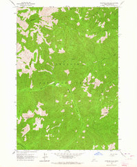
1963 · Sherman Peak
USGS Topo · 1:24,000