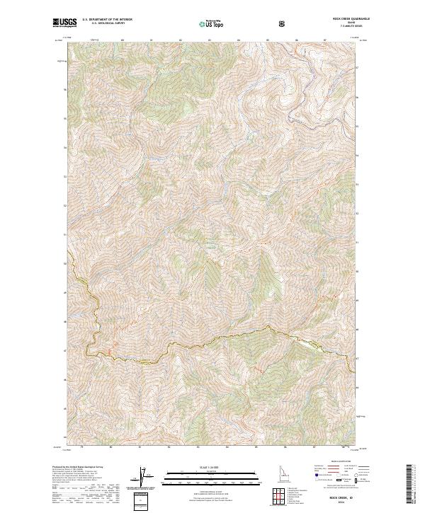
2024 Map of Rock Creek
USGS Topo · Published 2024About this map
The Challis National Forest dominates this Idaho landscape where the high-altitude divide between Lemhi and Custer counties is defined by steep ridges and an intricate drainage system. Centered on Rock Creek, the terrain is marked by a network of primitive routes and historic trails that trace the movements of early forest rangers and backcountry travelers. These include the Sleeping Deer-Road (Winter Trl) and specialized paths like the Hot Creek Ridge Trl and Bridge Creek Ridge Trl. The map illustrates a wilderness economy built on water and access, where deep canyons such as Loon Creek and Warm Spring Creek serve as primary corridors through the high country. The convergence of numerous named forks, including South Fork Camas Creek and Peanut Creek, highlights the complex topography of the Salmon River Mountains.
Find a feature on this map
29 named features on this map. Tap any name to fly to it.
Don’t see what you’re looking for? This feature index may not catch every label — zoom into the map to look around manually.
Map Details
Editions of this 2024 Rock Creek Map
This is the sole edition of this map. No revisions or reprints were ever made.
Other maps of this area

1930 · Casto
USGS Topo · 1:125,000

1957 · Challis
USGS Topo · 1:250,000

1960 · Challis
USGS Topo · 1:250,000

1962 · Ramey Hill
USGS Topo · 1:24,000

1963 · Challis
USGS Topo · 1:250,000

1963 · Challis Creek Lakes
USGS Topo · 1:24,000

1963 · Meyers Cove
USGS Topo · 1:24,000

1963 · Casto
USGS Topo · 1:24,000

1963 · Rock Creek
USGS Topo · 1:24,000
1963 · Sherman Peak
USGS Topo · 1:24,000