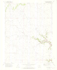
1972 Map of Rock Crossing
USGS Topo · Published 1976About this map
Rock Crossing serves as the namesake hub of this Colorado landscape, characterized by the intricate drainage systems that define the high plains of Las Animas County. The map details a complex network of seasonal watercourses, most notably the winding Taylor Arroyo and Big Water Arroyo, which carve distinct paths across the terrain. These ephemeral streams are joined by Burke Arroyo, illustrating the critical role of surface water management in this arid region.
Find a feature on this map
7 named features on this map. Tap any name to fly to it.
Don’t see what you’re looking for? This feature index may not catch every label — zoom into the map to look around manually.
Map Details
Editions of this 1972 Rock Crossing Map
4 editions found
Other maps of this area

1891 · Timpas
USGS Topo · 1:125,000

1891 · Apishapa
USGS Topo · 1:125,000

1891 · Mesa De Maya
USGS Topo · 1:125,000

1892 · Elmoro
USGS Topo · 1:125,000

1893 · Apishapa
USGS Topo · 1:125,000

1893 · Elmoro
USGS Topo · 1:125,000

1893 · Mesa de Maya
USGS Topo · 1:125,000

1894 · Timpas
USGS Topo · 1:125,000

1897 · Elmoro
USGS Topo · 1:125,000

1897 · Apishapa
USGS Topo · 1:125,000