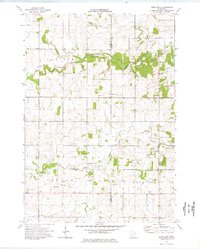
1974 Map of Rock Dell
USGS Topo · Published 1976About this map
Rock Dell and the surrounding townships of Canisteo, Salem, and Vernon characterize this mid-1970s landscape on the border of Dodge and Olmsted Counties. The region is defined by the winding course of Salem Creek and the South Fork Zumbro River, which cut through a predominantly agricultural terrain marked by numerous Gravel Pits and a Sandpit. Local life centers on rural crossroads and spiritual landmarks such as East St Olaf Ch, West St Olaf Ch, and the Zion Cem. A notable cluster of activity appears at Shanty Town in the northeast, while the southern half of the map shows the transition into Oslo and the namesake township of Rock Dell. The detailed mapping of fence and field lines provides a precise view of mid-century land use and property boundaries in this part of Southern Minnesota.
Find a feature on this map
21 named features on this map. Tap any name to fly to it.
Don’t see what you’re looking for? This feature index may not catch every label — zoom into the map to look around manually.
Map Details
Editions of this 1974 Rock Dell Map
This is the sole edition of this map. No revisions or reprints were ever made.
Other maps of this area

1953 · Saint Paul
USGS Topo · 1:250,000

1954 · Mason City
USGS Topo · 1:250,000

1955 · High Forest
USGS Topo · 1:62,500

1957 · Mason City
USGS Topo · 1:250,000

1958 · Mason City
USGS Topo · 1:250,000

1959 · Saint Paul
USGS Topo · 1:250,000

1965 · Dodge Center
USGS Topo · 1:24,000

1965 · Byron
USGS Topo · 1:24,000

1966 · Douglas
USGS Topo · 1:24,000
1966 · Hayfield
USGS Topo · 1:24,000