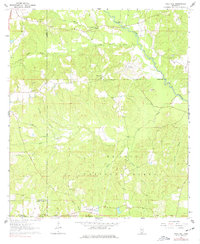
1963 Map of Rock Hill
USGS Topo · Published 1977About this map
De Soto National Forest dominates this Mississippi landscape, where the meandering course of Black Creek defines the northern and eastern reaches of the area. This 1963 survey captures the rural character of Forrest and Lamar counties just before the mid-century, a time when the timberlands were punctuated by small, family-centered settlements and isolated institutions like the County Home. The network of small streams, including Little Black Creek and Sleeper Creek, provided the drainage for a region characterized by prominent terrain features such as Pistol Ridge and Elder Ridge.
Find a feature on this map
35 named features on this map. Tap any name to fly to it.
Don’t see what you’re looking for? This feature index may not catch every label — zoom into the map to look around manually.
Map Details
Editions of this 1963 Rock Hill Map
3 editions found

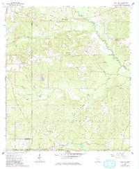
Other maps of this area

1947 · Wiggins
USGS Topo · 1:62,500

1947 · New Augusta
USGS Topo · 1:62,500

1949 · Wiggins
USGS Topo · 1:62,500

1949 · New Augusta
USGS Topo · 1:62,500

1953 · Hattiesburg
USGS Topo · 1:250,000

1953 · Mobile
USGS Topo · 1:250,000

1957 · Mobile
USGS Topo · 1:250,000

1958 · Hattiesburg
USGS Topo · 1:250,000

1958 · Carnes
USGS Topo · 1:62,500

1960 · Mobile
USGS Topo · 1:250,000