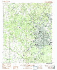
1984 Map of Rock Hill West
USGS Topo · Published 1985About this map
Rock Hill and its western suburbs appear here during a period of significant institutional and educational density in York County. The map highlights a concentration of higher education including Winthrop College, Friendship College, and Clinton Jr College, alongside numerous public schools like Northwestern High Sch. This 1980s landscape is defined by its transition from the historic rural roots seen at Newport and Ebenezer to the expanding urban grid of the city. The Southern railroad line cuts through the terrain, connecting established neighborhoods and industrial areas like the Gravel Pit to the broader regional economy. Significant community landmarks, from the National Guard Armory to the Catawba Community Pre-Release Center, sit among a network of local watercourses like Wildcat Creek and Fishing Creek, illustrating the intersection of civil infrastructure and the rolling Piedmont geography.
Find a feature on this map
70 named features on this map. Tap any name to fly to it.
Don’t see what you’re looking for? This feature index may not catch every label — zoom into the map to look around manually.
Map Details
Editions of this 1984 Rock Hill West Map
2 editions found
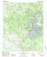
Other maps of this area

1905 · Charlotte
USGS Topo · 1:48,000

1907 · Charlotte
USGS Topo · 1:62,500

1941 · Charlotte
USGS Topo · 1:125,000

1941 · Spartanburg
USGS Topo · 1:250,000

1942 · Charlotte
USGS Topo · 1:125,000

1947 · Clover
USGS Topo · 1:62,500

1949 · Clover
USGS Topo · 1:62,500

1949 · Rock Hill
USGS Topo · 1:62,500

1953 · Spartanburg
USGS Topo · 1:250,000

1953 · Charlotte
USGS Topo · 1:250,000