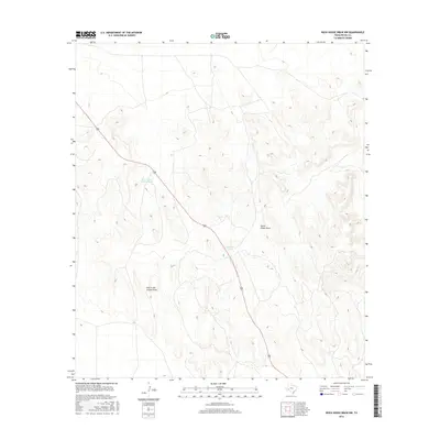
2016 Map of Rock House Draw NW
USGS Topo · Published 2016About this map
Stockton Tank and Hole-in-the-Ground Tank provide essential water points in this arid reach of West Texas, reflecting the enduring ranching infrastructure of Pecos County. The landscape is defined by the drainage patterns of South Linger Draw and Hole in the Ground Draw, which carve through the high desert terrain. Bisecting the quadrangle, Highway 285 serves as the primary artery for travel through this sparse region. This 2016 survey highlights the relationship between topography and survival, where named tanks like these were historically vital for livestock and travelers in an environment where surface water is a rare commodity.
Find a feature on this map
5 named features on this map. Tap any name to fly to it.
Don’t see what you’re looking for? This feature index may not catch every label — zoom into the map to look around manually.
Map Details
Editions of this 2016 Rock House Draw NW Map
This is the sole edition of this map. No revisions or reprints were ever made.
Other maps of this area

1921 · Fort Stockton
USGS Topo · 1:62,500

1923 · Fort Stockton
USGS Topo · 1:62,500

1923 · Sierra Madera
USGS Topo · 1:62,500

1928 · Comanche Spring
USGS Topo · 1:125,000

1954 · Fort Stockton
USGS Topo · 1:250,000

1958 · Fort Stockton
USGS Topo · 1:250,000
1970 · Panther Bluff
USGS Topo · 1:24,000
1970 · East Mesa SW
USGS Topo · 1:24,000
1970 · Fivemile Mesa
USGS Topo · 1:24,000

1973 · Fort Stockton
USGS Topo · 1:250,000