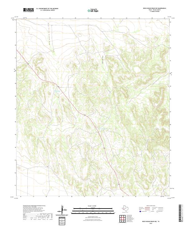
2022 Map of Rock House Draw NW
USGS Topo · Published 2022About this map
Hole in the Ground Draw and South Linger Draw define the drainage patterns of this Pecos County landscape, where the arid terrain is shaped by intermittent water flow. This 2022 survey illustrates the reliance on localized water management in West Texas, featuring infrastructure such as Hole-in-the-Ground Tank and Stockton Tank. These man-made features are critical markers for land management and livestock in a region characterized by broad draws and subtle elevation shifts. The map provides a precise view of the modern road network cutting through the open country, reflecting the contemporary balance between ranching needs and the natural topography of the Trans-Pecos region.
Find a feature on this map
4 named features on this map. Tap any name to fly to it.
Don’t see what you’re looking for? This feature index may not catch every label — zoom into the map to look around manually.
Map Details
Editions of this 2022 Rock House Draw NW Map
This is the sole edition of this map. No revisions or reprints were ever made.
Other maps of this area

1921 · Fort Stockton
USGS Topo · 1:62,500

1923 · Fort Stockton
USGS Topo · 1:62,500

1923 · Sierra Madera
USGS Topo · 1:62,500

1928 · Comanche Spring
USGS Topo · 1:125,000

1954 · Fort Stockton
USGS Topo · 1:250,000

1958 · Fort Stockton
USGS Topo · 1:250,000
1970 · Panther Bluff
USGS Topo · 1:24,000
1970 · East Mesa SW
USGS Topo · 1:24,000
1970 · Fivemile Mesa
USGS Topo · 1:24,000

1973 · Fort Stockton
USGS Topo · 1:250,000