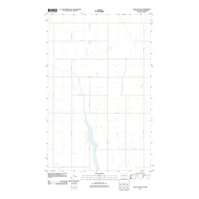
2011 Map of Rock Lake NW
USGS Topo · Published 2011About this map
Glacial depressions and scattered wetlands define this prairie landscape along the North Dakota and Manitoba border during the early 21st century. The terrain is organized by a strict cardinal grid of rural roads, including 109th St NE at the northern boundary and 67th Ave NE to the west. This layout reflects the enduring influence of the Public Land Survey System on the region's agricultural development. A central north-south drainage system, bracketed by 68th Ave NE and 70th Ave NE, funnels water through a string of ephemeral ponds and larger basins, illustrating the local hydrology before modern intensive land management. The sparse distribution of named infrastructure like 101st St NE highlights the open, rural character of this international borderland.
Find a feature on this map
14 named features on this map. Tap any name to fly to it.
Don’t see what you’re looking for? This feature index may not catch every label — zoom into the map to look around manually.
Map Details
Editions of this 2011 Rock Lake NW Map
This is the sole edition of this map. No revisions or reprints were ever made.
Other maps of this area

1953 · Devils Lake
USGS Topo · 1:250,000

1956 · Devils Lake
USGS Topo · 1:250,000
1969 · Hansboro NE
USGS Topo · 1:24,000

1969 · Rock Lake NE
USGS Topo · 1:24,000
1969 · Rock Lake NW
USGS Topo · 1:24,000

1970 · Hansboro SE
USGS Topo · 1:24,000

1970 · Rock Lake
USGS Topo · 1:24,000

1970 · Rock Lake SE
USGS Topo · 1:24,000

1985 · Rock Lake
USGS Topo · 1:100,000
2011 · Rock Lake SE
USGS Topo · 1:24,000