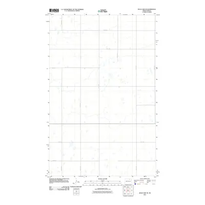
2011 Map of Rock Lake SE
USGS Topo · Published 2011About this map
Glacial prairie potholes and seasonal wetlands define this rural landscape in Cavalier County during the early 21st century. The terrain is organized by a precise grid of section-line roads, such as 100th St Ne and 73rd Ave Ne, which facilitate the region's agricultural movement. These thoroughfares, including 98th St Ne and 76th Ave Ne, provide access to the numerous small water bodies scattered across the plains. This 2011 survey by the U.S. Geological Survey reflects the enduring rural character of North Dakota's northeast corner, where the absence of large settlements highlights a sparsely populated landscape shaped by drainage patterns and large-scale farming operations.
Find a feature on this map
11 named features on this map. Tap any name to fly to it.
Don’t see what you’re looking for? This feature index may not catch every label — zoom into the map to look around manually.
Map Details
Editions of this 2011 Rock Lake SE Map
This is the sole edition of this map. No revisions or reprints were ever made.
Other maps of this area

1953 · Devils Lake
USGS Topo · 1:250,000

1956 · Devils Lake
USGS Topo · 1:250,000

1962 · Egeland
USGS Topo · 1:24,000

1962 · Snyder Lake
USGS Topo · 1:24,000

1969 · Rock Lake NE
USGS Topo · 1:24,000
1969 · Rock Lake NW
USGS Topo · 1:24,000

1970 · Calvin
USGS Topo · 1:24,000

1970 · Sarles
USGS Topo · 1:24,000

1970 · Rock Lake
USGS Topo · 1:24,000

1970 · Rock Lake SE
USGS Topo · 1:24,000