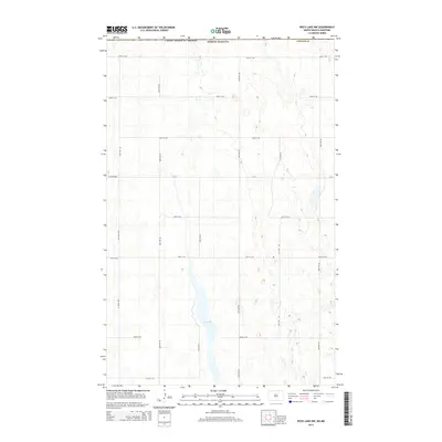
2014 Map of Rock Lake NW
USGS Topo · Published 2014About this map
Rock Lake sits at the heart of this North Dakota borderland, surrounded by a precise grid of rural routes and farm access roads. This 2014 survey captures the landscape of Towner Co just south of the international boundary between the United States and Canada. The terrain is defined by its glacial prairie potholes and wetlands, interspersed with a road network including Co Road 4819 and Co Road 4804. The map provides a detailed view of section lines and rural infrastructure, tracing throughways from 109th St NE at the northern edge down to 101st St NE. For those studying the geography of north-central North Dakota, it reveals the intricate drainage patterns and local travel corridors like 67th Ave NE and 72nd Ave NE that serve this agricultural region.
Find a feature on this map
19 named features on this map. Tap any name to fly to it.
Don’t see what you’re looking for? This feature index may not catch every label — zoom into the map to look around manually.
Map Details
Editions of this 2014 Rock Lake NW Map
This is the sole edition of this map. No revisions or reprints were ever made.
Other maps of this area

1953 · Devils Lake
USGS Topo · 1:250,000

1956 · Devils Lake
USGS Topo · 1:250,000
1969 · Hansboro NE
USGS Topo · 1:24,000

1969 · Rock Lake NE
USGS Topo · 1:24,000
1969 · Rock Lake NW
USGS Topo · 1:24,000

1970 · Hansboro SE
USGS Topo · 1:24,000

1970 · Rock Lake
USGS Topo · 1:24,000

1970 · Rock Lake SE
USGS Topo · 1:24,000

1985 · Rock Lake
USGS Topo · 1:100,000
2011 · Rock Lake SE
USGS Topo · 1:24,000