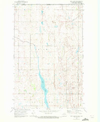
1969 Map of Rock Lake NW
USGS Topo · Published 1972About this map
The international boundary between Canada and the United States defines the northern edge of this landscape in Towner County. This 1960s survey illustrates a region dominated by a sprawling network of wetlands and small water bodies characteristic of the prairie pothole region. Central to the map is the northern reach of Rock Lake, which stretches southward through the township of Smith. The land is organized into a rigid grid of section lines and field boundaries, punctuated by isolated structures and benchmarks like BM 1545. A lone townhall stands as a civic marker in the center of the sheet, serving the surrounding rural communities of Dash and Lansing. The terrain is relatively flat, with subtle elevation changes marked by numerous small depressions that collect seasonal water, reflecting the agricultural and natural drainage patterns along the Manitoba and North Dakota border.
Find a feature on this map
11 named features on this map. Tap any name to fly to it.
Don’t see what you’re looking for? This feature index may not catch every label — zoom into the map to look around manually.
Map Details
Editions of this 1969 Rock Lake NW Map
This is the sole edition of this map. No revisions or reprints were ever made.
Other maps of this area

1953 · Devils Lake
USGS Topo · 1:250,000

1956 · Devils Lake
USGS Topo · 1:250,000
1969 · Hansboro NE
USGS Topo · 1:24,000

1969 · Rock Lake NE
USGS Topo · 1:24,000

1970 · Hansboro SE
USGS Topo · 1:24,000

1970 · Rock Lake
USGS Topo · 1:24,000

1970 · Rock Lake SE
USGS Topo · 1:24,000

1985 · Rock Lake
USGS Topo · 1:100,000
2011 · Rock Lake SE
USGS Topo · 1:24,000
2011 · Rock Lake
USGS Topo · 1:24,000