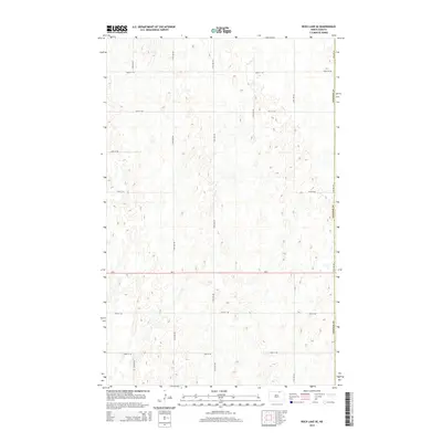
2014 Map of Rock Lake SE
USGS Topo · Published 2014About this map
Glacial prairie potholes and numerous small depressions dominate this northern North Dakota landscape along the western edge of Cavalier County. The terrain is defined by a rigorous section-line road grid, where local routes like 100th St Ne and 73rd Ave Ne intersect across a high-elevation plain. The eastern boundary of Towner Co runs along the western margin of this survey, marking the jurisdictional divide in this agricultural region. Bisecting the southern portion of the quadrangle, Nd-5 serves as the primary east-west corridor, connecting remote farmsteads and rural townships. The map illustrates a highly organized land-use pattern typical of the Red River Valley hinterlands, where every square mile is accessible by a systematic network of gravel roads including 93rd St Ne and 78th Ave Ne.
Find a feature on this map
14 named features on this map. Tap any name to fly to it.
Don’t see what you’re looking for? This feature index may not catch every label — zoom into the map to look around manually.
Map Details
Editions of this 2014 Rock Lake SE Map
This is the sole edition of this map. No revisions or reprints were ever made.
Other maps of this area

1953 · Devils Lake
USGS Topo · 1:250,000

1956 · Devils Lake
USGS Topo · 1:250,000

1962 · Egeland
USGS Topo · 1:24,000

1962 · Snyder Lake
USGS Topo · 1:24,000

1969 · Rock Lake NE
USGS Topo · 1:24,000
1969 · Rock Lake NW
USGS Topo · 1:24,000

1970 · Calvin
USGS Topo · 1:24,000

1970 · Sarles
USGS Topo · 1:24,000

1970 · Rock Lake
USGS Topo · 1:24,000

1970 · Rock Lake SE
USGS Topo · 1:24,000