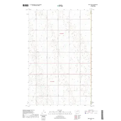
2017 Map of Rock Lake SE
USGS Topo · Published 2017About this map
Glacial prairie potholes and seasonal wetlands define this section of Cavalier County, where the landscape is organized by the rigid Public Land Survey System. The boundary with Towner Co marks the eastern edge of this agricultural expanse, dominated by the township blocks of T162n R65w and T161n R65w. A network of section-line roads, including 100th St NE, 99th St NE, and 75th Ave NE, provides the primary infrastructure for the area's farming economy. The map reveals the intricate drainage patterns of the region, where hundreds of small depressions collect water across the undulating plains. This 2017 survey reflects the modern rural layout of the North Dakota prairie, preserving the exact locations of rural transport arteries like 95th St NE and 73rd Ave NE as they navigate the natural terrain.
Find a feature on this map
17 named features on this map. Tap any name to fly to it.
Don’t see what you’re looking for? This feature index may not catch every label — zoom into the map to look around manually.
Map Details
Editions of this 2017 Rock Lake SE Map
This is the sole edition of this map. No revisions or reprints were ever made.
Other maps of this area

1953 · Devils Lake
USGS Topo · 1:250,000

1956 · Devils Lake
USGS Topo · 1:250,000

1962 · Egeland
USGS Topo · 1:24,000

1962 · Snyder Lake
USGS Topo · 1:24,000

1969 · Rock Lake NE
USGS Topo · 1:24,000
1969 · Rock Lake NW
USGS Topo · 1:24,000

1970 · Calvin
USGS Topo · 1:24,000

1970 · Sarles
USGS Topo · 1:24,000

1970 · Rock Lake
USGS Topo · 1:24,000

1970 · Rock Lake SE
USGS Topo · 1:24,000