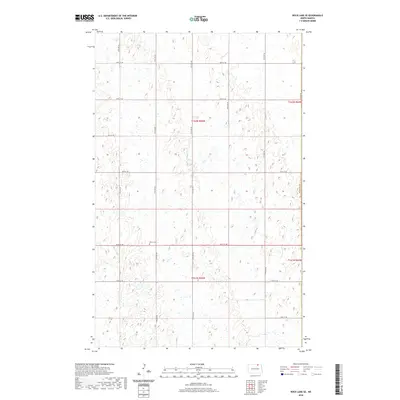
2020 Map of Rock Lake SE
USGS Topo · Published 2020About this map
Ellison Cem stands as a primary landmark in this rural landscape within Towner County and Cavalier County. This portion of the North Dakota prairie is characterized by a dense network of wetlands and small water bodies that define the local drainage patterns. The agricultural grid is firmly established by a systematic layout of section roads, such as 100th St NE, 95th St NE, and 75th Ave NE, which provide access across the township divisions of T161N and T162N. The map reveals the precise intersection of administrative boundaries and physical terrain, showing how early 21st-century infrastructure navigates the region's numerous sloughs and ponds.
Find a feature on this map
20 named features on this map. Tap any name to fly to it.
Don’t see what you’re looking for? This feature index may not catch every label — zoom into the map to look around manually.
Map Details
Editions of this 2020 Rock Lake SE Map
This is the sole edition of this map. No revisions or reprints were ever made.
Other maps of this area

1953 · Devils Lake
USGS Topo · 1:250,000

1956 · Devils Lake
USGS Topo · 1:250,000

1962 · Egeland
USGS Topo · 1:24,000

1962 · Snyder Lake
USGS Topo · 1:24,000

1969 · Rock Lake NE
USGS Topo · 1:24,000
1969 · Rock Lake NW
USGS Topo · 1:24,000

1970 · Calvin
USGS Topo · 1:24,000

1970 · Sarles
USGS Topo · 1:24,000

1970 · Rock Lake
USGS Topo · 1:24,000

1970 · Rock Lake SE
USGS Topo · 1:24,000