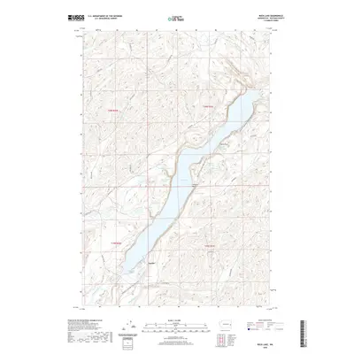
2020 Map of Rock Lake
USGS Topo · Published 2020About this map
Rock Lake dominates this portion of the Palouse, its elongated waters following a basalt-carved coulee. The settlement of Lavista and the shoreline at Johnsons Beach anchor the human presence in a landscape shaped by glacial flooding. Transportation through this remote terrain follows the water, most notably via the Palouse To Cascades State Park Trail, which traces a historic railroad grade along the eastern edge of the lake and through Slaughter Pen Bay. Small ponds and seasonal waters like Alkali Lake, Tule Lake, and Slaughter Pen Pond dot the surrounding plateaus, while drainage is managed by systems like Kamiache Cr and Rock Creek. These features illustrate the transition from early homesteading and rail-based commerce to contemporary recreational use. The map also records numerous local roads, such as Miller Rd and Glorfield Rd, which serve the agricultural sections of Whitman County.
Find a feature on this map
75 named features on this map. Tap any name to fly to it.
Don’t see what you’re looking for? This feature index may not catch every label — zoom into the map to look around manually.
Map Details
Editions of this 2020 Rock Lake Map
This is the sole edition of this map. No revisions or reprints were ever made.
Other maps of this area

1954 · Cheney
USGS Topo · 1:62,500

1954 · Sprague
USGS Topo · 1:62,500

1955 · Spokane
USGS Topo · 1:250,000

1958 · Spokane
USGS Topo · 1:250,000

1964 · Lamont NE
USGS Topo · 1:24,000

1964 · St. John
USGS Topo · 1:24,000

1964 · Rock Lake
USGS Topo · 1:24,000

1964 · Texas Lake
USGS Topo · 1:24,000

1964 · Pine City
USGS Topo · 1:24,000

1964 · Ewan
USGS Topo · 1:24,000